
Types of observations
Meteorological observations are essential for understanding and predicting weather and climate. There are three main types of observations.
Marine observations
Marine observations are a critical component of surface weather data, collected over the oceans. They serve several key purposes:
Forecasts and warnings:
Help ships and offshore operators avoid severe weather.
Model input:
Feed data into computer models for atmospheric predictions.
Climate understanding:
Provide long-term meteorological information to aid understanding of the global climate.
Atmospheric changes over months, decades, and centuries are closely linked to ocean conditions. Observations below the surface are vital for understanding ocean circulation and initialising ocean models.
Sources of marine observations
We gather marine data from five main sources:
- Marine Automatic Weather Stations (MAWS): Moored buoys, light vessels, offshore installations.
- Drifting buoys: Small buoys that move with ocean currents.
- Voluntary Observing Ships (VOS): Merchant ships crossing global oceans.
- Shipborne automatic weather stations: Installed on ships in UK coastal waters.
- Argo floats: Devices that descend to ocean depths for measurements.
The observations made and funded by the Met Office are part of an international effort coordinated by organisations like the World Meteorological Organization (WMO), International Maritime Organisation (IMO), and EUMETNET.
Marine Automatic Weather Stations
We operate a network of MAWS, including moored buoys in coastal-inshore, open-ocean and deep-water locations; and systems on lightships and islands. These stations measure air pressure, temperature, humidity, wind speed/direction, wave height/period, and more.
Moored and drifting buoys
Moored buoys are robust, solar-powered, and designed for harsh Atlantic conditions, transmitting hourly data year-round. Out of the water each buoy stands 6 m tall, measures 3 m in diameter, weighs 4.5 tonnes and has anchor cables several kilometres in length to moor it in the deep ocean off the continental shelf. It operates for up to two years between service visits.
Drifting buoys provide crucial data for forecasting and climate studies, measuring sea temperature and air pressure, and tracking ocean currents. Along with Voluntary Observing Ships, they are the primary source of air pressure data over the oceans required by our weather forecasting models. The buoys are battery powered and typically last for one to two years. Measurements are normally made hourly and the data are transmitted to satellite. Most drifting buoys use the Argo floats satellite system for data transmission and positioning.
We add to the global array of drifting buoys each year by deploying buoys in the North Atlantic. This contributes to the Global Ocean Observing System (GOOS).
Lightships and Island systems
Lightships, permanently moored with navigation beacons, host weather stations that measure visibility in addition to standard meteorological variables. Island systems, such as those on Foula and Sule Skerry, provide valuable data for specific operational needs, like deploying pilots to nearby oil tankers.
Shipborne Automatic Weather Stations (AWS)
Automation has increased, with AWS systems now installed on ferries, container ships, and research vessels. These systems enable hourly, automated data transmission. We have developed our own AWS system called AMOS ( Autonomous Marine Observing System) which measures pressure, temperature and humidity and has the capacity to be extended to report additional parameters. Because it is an autonomous system it can be easily installed on a host ship in a matter of hours and because it is solar powered it is independent of the ship’s own systems.
Observations from ships
Merchant ships and offshore oil platforms offer convenient sites for making meteorological observations in locations over the open ocean which would otherwise be devoid of data. We maintain an observing capability on several hundred Voluntary Observing Ships (VOS) operating across the world’s oceans. The collected meteorological data supports global initiatives like the World Weather Watch and JCOMM VOS Scheme. Observations are typically made every 3–6 hours and transmitted back to us via satellite.
VOS climate ships
Over 150 UK vessels have been upgraded to report higher-quality data for climate applications, accessible to researchers through the VOS Climate Project.
Monitoring received data
We act as one of two Global Collecting Centres for Marine Climatological Data (alongside the German Met. Service DWD), with responsibility for basic quality control of ship data, and collection of those data not available in real-time The Met Office is also a lead centre for monitoring the real-time surface marine data from the VOS and drifting buoys.
Observations from space
Meteorological satellites are divided into two main categories:
Geostationary satellites:
Orbit the earth once every 24 hours at 35,800 km above the equator, providing continuous images of the same region.
We contribute to the European operated geostationary satellite, Meteosat, ideally positioned over the Greenwich meridian to observe weather systems that affect the UK and the rest of Europe.
Polar orbiting satellites:
Orbit the earth about every 100 minutes at about 850 km, offering measurements at far greater resolution. Over the course of the day they view most parts of the earth at least twice. Their orbits are sun-synchronous, which means that they see that same part of the earth at the same local time each day.
We contribute to the European polar orbiter, Metop, and make use of data from similar satellites operated by US agency NOAA and others.
Sources of space observations
Data from space observations come from several different sources and using different technologies including:
- Satellite imagery and soundings
- Wind scatterometers
- Global satellite navigation systems
- Altimeters and Doppler wind lidars on low orbit satellites
Satellite imagery
Satellite images, both visible and infrared, are used to monitor cloud movement, precipitation, sea surface temperature, sea ice, snow cover, fog, dust storms, pollution, and volcanic ash.
Satellite soundings
Satellites use radiometers to measure atmospheric and surface radiation, providing vertical profiles of temperature and humidity—essential for weather models.
Wind scatterometers
Scatterometers are radar systems mounted on polar orbiting satellites. They direct radar pulses toward earth and measure the strength of the backscattered return beam. They can measure wind speed and direction over the oceans by analysing radar backscatter from small surface waves.
Global satellite navigation systems
Signals from navigation satellites (like GPS) are used to estimate atmospheric water vapour and temperature profiles, aiding thunderstorm prediction and climate studies.
Altimeters
Some satellites in low polar orbit carry altimeters that can measure ocean surface height, wave height, wind speed, sea ice thickness, and global sea level rise. These data are vital for ocean modelling and climate monitoring.
Doppler wind lidars
Lidars on low orbit meteorological satellites measure wind speed and direction by detecting Doppler shifts in laser pulses reflected from atmospheric particles.
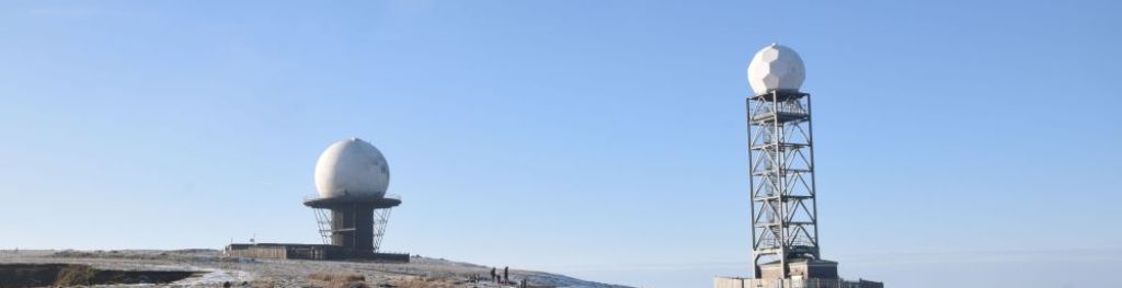
Weather radar observations
How weather radar works
Weather radars emit electromagnetic pulses to detect the location and intensity of precipitation (rain, hail, snow) in real time. Radar data is crucial for weather forecasting, aviation safety, and flood prediction.
UK and Ireland weather radar network
The network consists of 18 radars, providing 24/7 coverage with data processed into high-resolution precipitation maps. Each radar provides data out to 255 km, completing a series of scans about the vertical axis at different elevation angles every five minutes. Data is sent to Met Office headquarters where we ensures operational integrity by managing interference and safeguarding radio sites.
Meteorological observations—marine, satellite, and radar—are foundational for weather forecasting, climate research, and operational safety. Our extensive network and international partnerships ensure robust data collection and analysis, supporting both immediate forecasting needs and long-term climate understanding.