
High clouds
Clouds with a base above 20,000 feet including cirrus, cirrocumulus and cirrostratus clouds.
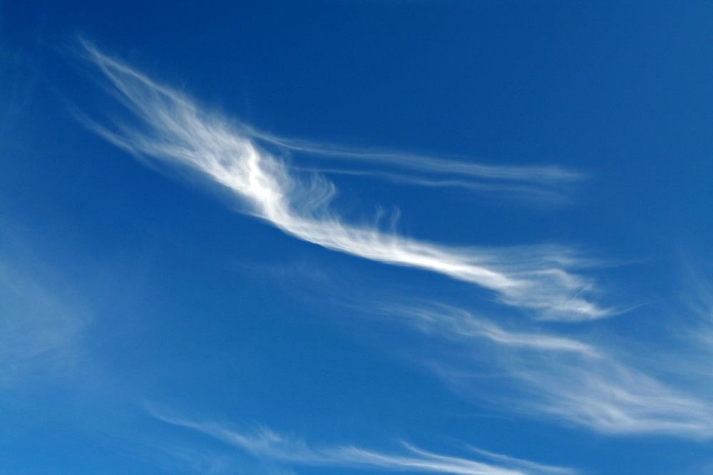
Cirrus clouds
- Height of base: 20,000 - 40,000 ft
- Shape: layered, tufty or patchy
- Latin: cirrus - lock or tuft of hair
- Precipitation: none
Cirrus clouds are short, detached, hair-like clouds found at high altitudes. These delicate clouds are wispy, with a silky sheen, or look like tufts of hair. In the daytime, they are whiter than any other cloud in the sky. While the Sun is setting or rising, they may take on the colours of the sunset.
How do cirrus clouds form?
Cirrus clouds form from the ascent of dry air, making the small quantity of water vapour in the air undergo deposition into ice (to change from a gas directly into a solid). Cirrus is made up completely of ice crystals, which provides their white colour and form in a wide range of shapes and sizes.
Cirrus clouds can also form through contrails, the vapour trails left by planes as they fly through a dry upper troposphere. These streaks can spread out and become cirrus, cirrostratus and cirrocumulus.
What weather is associated with cirrus clouds?
They often form in advance of a warm front, where the air masses meet at high levels, indicating a change in the weather is on the way.
Technically these clouds produce precipitation but it never reaches the ground. Instead, it re-evaporates, creating virga clouds.
How do we categorise cirrus clouds?
Cirrus clouds have five defined 'species';
- Cirrus fibratus - Thin and fibrous, cirrus fibratus are often aligned with the high altitude wind direction, making for white parallel stripes which streak across the sky. These are the most common type of cirrus cloud
- Cirrus uncinus - With its trademark hook shape, cirrus uncinus is famous for looking like a horse's tail. These wispy streaks of cirrus cannot be seen without a characteristic 'flick' at the end of its tail
- Cirrus spissatus - These clouds sit right at the top of the troposphere. A thick, dense cirrus layer that dominates much of the sky above, often formed by passing warm fronts or the remnants of a cumulonimbus incus
- Cirrus floccus - Ragged cirrus patches which are much larger than cirrocumulus floccus. These have a more cotton wool-like appearance than the rest of the cirrus family
- Cirrus castellanus - More vertically developed than cirrus floccus, cirrus castellanus have turret-like tops and are taller than they are wide.
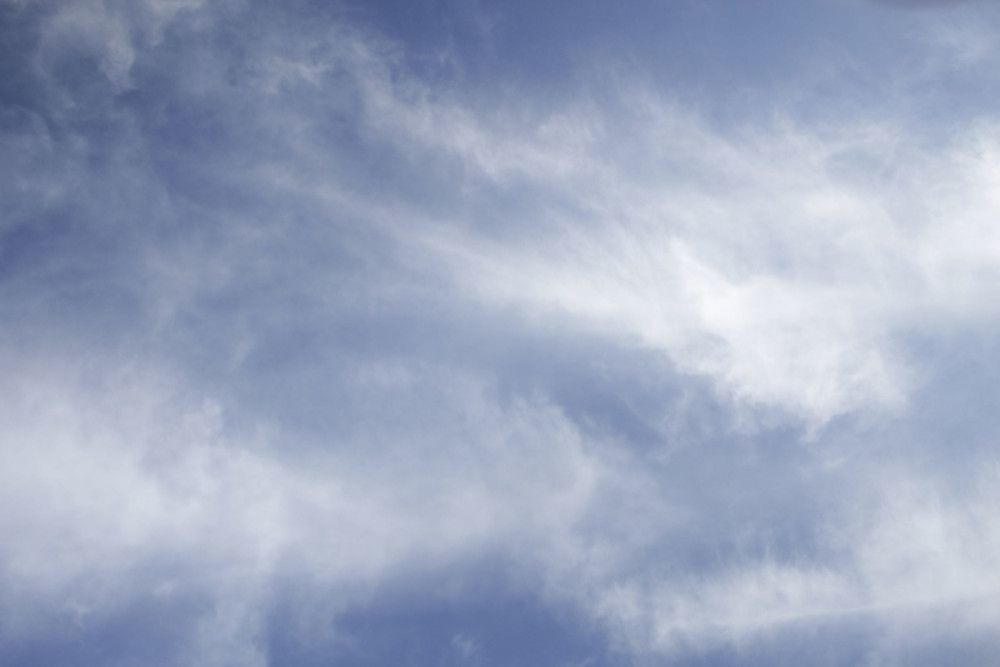
Cirrostratus clouds
- Height of base: 20,000 - 40,000 ft
- Shape: Layered
- Latin: cirrus - lock or tuft of hair; stratus - flattened or spread out
- Precipitation: None
Cirrostratus are transparent high clouds, which cover large areas of the sky. They sometimes produce white or coloured rings, spots or arcs of light around the Sun or Moon, that are known as halo phenomena. Sometimes they are so thin that the halo is the only indication that a cirrostratus cloud is in the sky.
Cirrostratus clouds can span thousands of miles, can be smooth or fibrous and are often fringed with cirrus clouds. Shadows will normally still be cast by the Sun when shining through cirrostratus clouds, which can help distinguish them from similar altostratus clouds.
How do cirrostratus clouds form?
As a result of slowly rising air, cirrostratus cloud can form. Usually generated at the forefront of frontal weather systems, the movements of cirrostratus can be used to predict what the weather will do in the next 24 hours.
Cirrostratus clouds can also form through contrails, the vapour trails left by planes as they fly through a dry upper troposphere. These streaks can spread out and become cirrus, cirrostratus and cirrocumulus.
What weather is associated with cirrostratus clouds?
Though cirrostratus itself does not produce precipitation, it can indicate whether or not precipitation is likely. If cirrostratus nebulosus exists in the sky it is likely that an incoming warm front will bring persistent rain within a day. If cirrostratus fibratus is spotted, stratus may proceed it, bringing only light drizzle.
How do we categorise cirrostratus clouds?
There are two main 'species' of cirrostratus:
- Cirrostratus fibratus - similar to cirrus, but with more consistency. Wispy strands all tightly knitted together, making for more of an animal fur look
- Cirrostratus nebulosus - a uniform veil-like layer covering the sky. Sometimes almost unnoticeable, cirrostratus nebulosus is featureless, composed entirely of ice
Cirrocumulus clouds
- Height of base: 20,000 - 40,000 ft
- Shape: layers or patches of cells
- Latin: cirrus - lock or tuft of hair; cumulus - heap
- Precipitation: none
Cirrocumulus is a relatively rare cloud, forming ripples which may resemble honeycomb. They are made up of lots of small white clouds called cloudlets, which are usually grouped together at high levels. Composed almost entirely from ice crystals, the little cloudlets are regularly spaced, often arranged as ripples in the sky.
Cirrocumulus can sometimes appear to look like the scaly skin of a fish and is referred to as a mackerel sky.
How do cirrocumulus clouds form?
Cirrocumulus cloudlets are usually made up of both ice and 'supercooled' water. This means that the water remains a liquid, even at temperatures well below 0oC. They form when turbulent vertical currents meet a cirrus layer, creating the puffy cumulus shape.
Cirrocumulus clouds can also form through contrails, the vapour trails left by planes as they fly through a dry upper troposphere. These streaks can spread out and become cirrus, cirrostratus and cirrocumulus.
What weather is associated with cirrocumulus clouds?
Precipitation from cirrocumulus clouds never reaches the surface, meaning that these clouds are usually associated with fair weather. However, their appearance can often prelude stormy weather, meaning you should make the most of the Sun while you still can.
How do we categorise cirrocumulus clouds?
Cirrocumulus has four defined 'species' which describe its appearance;
- Cirrocumulus stratiformis - flat sheets or patches of cirrocumulus, with fine separation leading to a fish scale-like appearance
- Cirrocumulus lenticularis - high-level icy lenses, similar to lenticular clouds but much less common. These are often larger than the usual altocumulus cloudlet, with a rounded shape
- Cirrocumulus floccus - fluffy tufts of cirrocumulus, with a more rugged appearance than other species. These often occur in smaller patches with a wide range of other cirroform clouds in the sky
- Cirrocumulus castellanus - taller than they are wide, cirrocumulus castellanus resemble tiny towers sitting high in the sky