
What is fog?
Fog is essentially a cloud at ground level that causes a reduction in visibility to less than 1000 metres.
What causes fog?
Fog, like clouds, is caused by tiny water droplets suspended in the air, but not all fog forms in the same way and there are a few different types of fog.
Dense fog is when the visibility falls below 100 metres which can cause severe travel disruption. The thickest fogs tend to occur in industrial areas where there are more pollution particles in the air allowing water droplets to coalesce and grow.
What are the different types of fog?
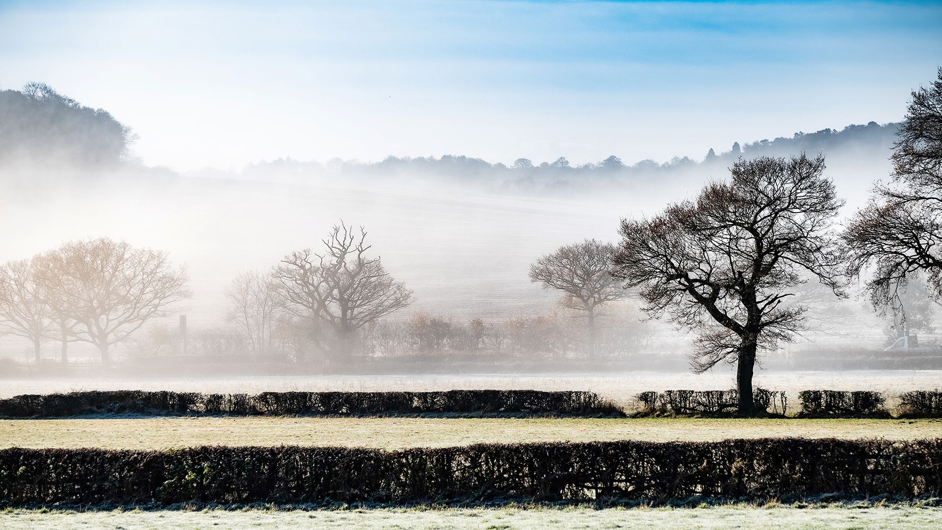
Radiation fog
Usually occurs in the winter, aided by clear skies and calm conditions. The cooling of land overnight by thermal radiation cools the air close to the surface. This reduces the ability of the air to hold moisture, allowing condensation and fog to occur. Radiation fog usually dissipates soon after sunrise as the ground warms. An exception to this can be in high elevation areas where the Sun has little influence in heating the surface.
Valley fog
Forms where cold dense air settles into the lower parts of a valley, condensing and forming fog. It is often the result of a temperature inversion, with warmer air passing above the valley. Valley fog is confined by local topography and can last for several days in calm conditions during the winter.
Advection fog
Occurs when moist, warm air passes over a colder surface and is cooled. A common example of this is when a warm front passes over an area with snow cover. It is also common at sea when moist tropical air moves over cooler waters. If the wind blows in the right direction, then sea fog can become transported over coastal land areas.
Upslope fog
Forms when winds blow air up a slope (called orographic uplift). The air cools as it rises, allowing moisture in it to condense.
Evaporation fog
Caused by cold air passing over warmer water or moist land. It often causes freezing fog, or sometimes frost. When some of the relatively warm water evaporates into low air layers, it warms the air, causing it to rise and mix with the cooler air that has passed over the surface. The warm, moist air cools as it mixes with the colder air, allowing condensation and fog to occur. Examples include steam fog over heated pools or when cold air moves over warm seas in autumn.
Freezing fog
Forms like normal fog but at sub-zero temperatures. They become supercooled water droplets remaining liquid even though they are below freezing temperature. This occurs because liquid needs a surface to freeze upon. When droplets from freezing fog freeze onto surfaces, a white deposit of feathery ice crystals is formed. This is referred to as rime; rime is a characteristic of freezing fog and is often seen on vertical surfaces exposed to the wind.
We tend to get freezing fog in the UK during winter, when temperatures are around freezing and there are clear skies and calm conditions. Any rime that develops as a result of freezing fog will be visible on the windward side of the object. It is quite rare for rime to develop at low levels in the UK, however it is more frequent on mountain tops and higher ground.
Coastal fog
Frequent along the UK’s east coast in spring and summer, known locally as Haar or in some parts of the UK. Coastal fog is usually a result of advection fog which forms when relatively warm, moist air passes over a cool surface. In the UK, the most common occurrence of coastal fog is when warm air moves over the cool surface of the North Sea towards the east coast of the UK.
When this happens, the cold air just above the sea's surface cools the warm air above it until it can no longer hold its moisture. This forces the warm air to condense, forming tiny particles of water which forms the fog that we see.
The impact, location and movement of coastal fog depend upon a number of conditions, including wind strength, wind direction and land temperature. If, as is common along the UK's east coast, the winds blow in from the east, the fog will often rapidly cover the coast in a blanket of fog. If the land temperature is warm, the fog can quickly dissipate as the parcel of air warms. However, if the land temperature is cooler, the fog can linger for a longer time.
Coastal fog might also refer to pre-existing fog which is transferred from a distant source and is simply moved to the coast by prevailing weather patterns.
The sudden onset of coastal fog can sometimes be dangerous, causing disorientation as it dramatically reduces visibility. It can also affect industries such as shipping and oil platforms, where it has been known for stubborn coastal fog to disrupt productivity for long periods.
What is the difference between mist, fog and haze?
Fog, mist and haze all affect visibility, which is an important part of forecasts affecting many aspects of life, from driving conditions to shipping and aviation.
Fog and mist differ by how far you can see through them.
Fog
By international agreement (particularly for aviation purposes) fog is the name given to resulting visibility less than 1,000 metres away. However, in forecasts for the public, this generally refers to visibility less than 180 m.
Mist
Visibility over 1,000 metres away. Like fog, mist is still the result of the suspension of water droplets, but simply at a lower density.
Mist typically is quicker to dissipate and can rapidly disappear with even slight winds, it's also what you see when you can see your breath on a cold day.
Haze
This is a slightly different phenomenon which is a suspension of extremely small, dry particles in the air, not water droplets. These particles are invisible to the naked eye, but sufficient to give the air an opalescent appearance.
These particles can also contribute to creating a red sky at sunrise or sunset.
How do you forecast fog?
For fog to form we need a few ingredients; moisture, light winds and a certain temperature called the ‘fog point’.
Fog is essentially a very low-lying cloud. For clouds to form, the air must be cooled to a point where its moisture condenses out into a visible cloud. The cooling normally occurs as air rises, but in the case of fog we have to wait for the air to cool down to its fog point naturally. This will be very dependent on the time of year, how much cloud cover there is, the strength of the wind, the amount of moisture in the air and the geographical location.
The main types of fog are radiation, valley, advection, upslope and evaporation. Here we look at radiation fog, and the ideal conditions for its formation are clear skies, light winds and plenty of moisture. If there is a high moisture content in the air, the temperature will not have to fall as far to reach the fog point and there will be a greater risk of fog forming. This is often why fog forms more readily around lakes, rivers and reservoirs.
Winds need to be gentle enough to keep the moisture in the air at the right concentration. Too light and it’ll form dew; too strong and the moisture will be mixed through the air and probably keep temperatures too high.
Clear skies at night allow temperatures to drop as heat escapes more readily from the Earth’s surface. With the right wind, moisture and lack of cloud, the fog point will be reached.
However, in order to forecast the fog point for the coming night we need to know the maximum temperature reached during the day. Bearing in mind we may be forecasting fog a few days ahead, the maximum temperature will also need to be forecast.
To do this we must consider; the amount of sunshine and how strong the sun is at a particular time of year, the wind speed and direction and whether they will change, how much cloud there is, whether there will be any rain, how much heat the ground has absorbed, and so on.
If any of those variables is different, even by a small amount, it will have a knock-on effect throughout the forecast. With so many factors at play, it’s easy to see that fog is one of the trickiest weather phenomena to forecast.