
What is frost and ice?
While we might usually see frost and ice as nothing more than frozen water, they can take a variety of mesmerising forms.
What are the different types of frost?
Frost occurs when the temperature of the air in contact with the ground is below the freezing point of water (‘ground frost’ or ‘air frost’, respectively).
Ground frost
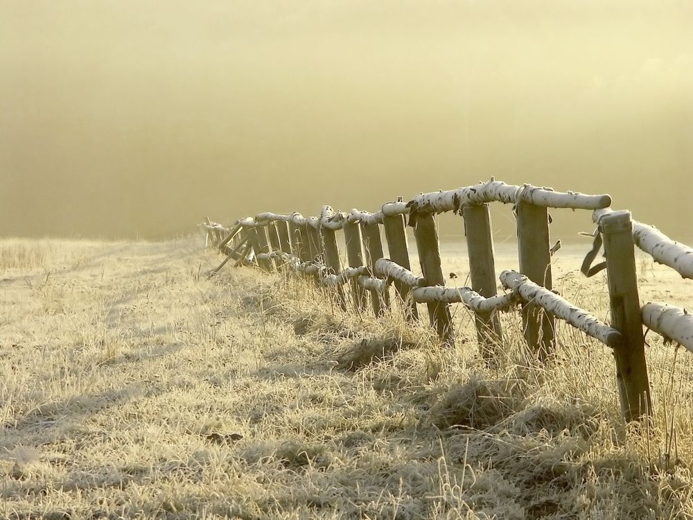
A ground frost refers to the formation of ice on the ground, objects, or trees, whose surface has a temperature below the freezing point of water. During situations when the ground cools quicker than the air, a ground frost can occur without an air frost. A grass frost, an unofficial type of ground frost, can occur when other surfaces - such as concrete or road surfaces - don't experience a frost, due to their better ability at holding onto any warmth. It is possible for a grass frost to occur in late spring or even early summer, when the risk of more widespread frosts has disappeared, and is something that gardeners in particular need to be aware of.
Air frost
An air frost occurs when the air temperature falls to or below the freezing point of water. An air frost is usually defined as the air temperature being below the freezing point of water at a height of at least one metre above the ground.
Hoar frost
Hoar frost is composed of tiny ice crystals and is formed by the same process as dew, but when the temperature of the surface is below the freezing point. The 'feathery' variety of hoar frost forms when the surface temperature reaches freezing point before dew begins to form on it. A 'white' frost, composed of more globular ice, occurs when the dew forms first, then subsequently freezes. The presence of fog tends to prevent the formation of hoar frost as it reduces the potential for radiational cooling of surfaces.
Glaze and rime
Frost is sometimes confused with glaze or rime. Rime is a rough white ice deposit that forms on vertical surfaces exposed to the wind. It is formed by supercooled water droplets of fog freezing on contact with a surface it drifts past.
Glaze can only form when supercooled rain or drizzle comes into contact with the ground, or non-supercooled liquid may produce glaze if the ground is well below 0°C. Glaze is a clear ice deposit that can be mistaken for a wet surface and can be highly dangerous.
What are the different types of ice?
Ice is simply water substance in a solid form. Ice can form over the surface of garden ponds, lakes and even rivers during exceptionally cold periods. It can also form over road surfaces, cars, building and vegetation in the form of black ice, frost or snow.
Glaze (clear ice)
Glaze is a smooth, transparent type of ice that forms when drizzle or rain hits a cold surface. It can either be formed when supercooled rain or drizzle comes into contact with the ground, or when non-supercooled liquid comes into contact within a surface that is well below 0°C.
Due to its transparent nature glaze can often be mistaken for a wet surface and can be highly dangerous, particularly when driving. It can also be damaging when it gains sufficient thickness. The extra weight caused by the accumulation of glaze can bring down branches of trees and, on rarer occasions, telephone lines. It can also pose a serious hazard to ships by adding weight to the structure.
Black ice
Glaze that forms on roads and pathways is often termed 'black ice' due to its transparent nature allowing the road surface below to be seen through it. Black ice is particularly dangerous since it can appear almost invisible to drivers. Find out more about driving in icy conditions.
Ice pellets
Ice pellets forms when snowflakes start to melt as they fall from the cloud, then fall through sub-freezing air, where they re-freeze into grain-like particles. Sometimes the snow may only partially melt and will fall as snow encased in a thin layer of ice. Ice pellets are generally smaller than hailstones and bounce when they hit the ground. Showers of ice pellets tend to be quite short-lived, but can still accumulate on the ground in a similar way to snow though forming a smaller, denser covering.
Hail
Hail is a shower of round or irregularly shaped pieces of ice, known as hailstones. They originate as small ice particles or frozen raindrops that are caught in the updraught of air inside a cumulonimbus cloud. As they ascend, they gather water on their surface and grow. How large they grow depends upon how much water is in the cloud and how strong the updraught is. Eventually the pieces of ice become so heavy that they can no longer be supported by the updraught and they fall to the ground.
Most hailstones are less than 25 mm in diameter, but they can grow up to 150 mm in diameter, with the potential to cause widespread damage to property and crops.
Hair ice
Hair ice is a rare type of ice formation where the presence of a particular fungus in rotting wood produces thin strands of ice which resemble hair or candy floss.
One of the first records of the phenomenon was made by Alfred Wegener (the discoverer of continental drift) in 1918. He observed a strange ice forming only on wet dead wood and proposed a theory that a specific fungi must be the catalyst for the smooth, silky hairs of ice. The conditions required for the formation of hair ice are extremely specific, hence the relative scarcity of sightings. To form, moist rotting wood from a broadleaf tree is required with the presence of moist air and a temperature slightly below 0°C. It is generally confined to latitudes between 45°N and 55°N. In 2015, the scientists Hofmann, Mätzler and Preuß determined the exact cause of the hair ice phenomenon, linking its formation to the presence of a specific fungus called Exidiopsis effusa.
The video below shows the formation of hair ice recorded by timelapse photography:
Ice pancakes
Ice pancakes are a rellatively rare phenomenon where discs of ice, anywhere from 20 - 200 cm wide, are formed in very cold oceans and lakes, creating a unique spectacle. They are most frequently seen in the Baltic Sea and around Antarctica but also form relatively frequently on the Great Lakes of the United States and Canada. They require some rather specific conditions in order to form and can form in one of two distinct ways.
- Wave action: waves cause forming pieces of ice to knock against each other rounding their edges as they freeze and grow. Small rims are created on the edges as the knocking causes splashing water to freeze and join the rim.
- River foam: foam on a river begins to freeze and join together and as they are sucked into an eddy (a swirling current of water) they form into a circular shape as a result. As other bits of frozen foam and ice hit the forming disc they freeze to it and increase its size.
Whilst ice pancakes look like solid discs, they are often quite slushy and easily break apart when lifted up. However, when given the conditions to consolidate, ice pancakes can end up binding with each other to form sheet ice and in rougher conditions waves can move these sheets of ice causing them to bend and crack to create ice ridges.
Ice pellets
Ice pellets are a type of solid precipitation that have a diameter of less than 5mm. They are spherical or irregular and rarely conical. Ice pellets form when snowflakes start to melt as they fall from the cloud, then fall through sub-freezing air where they re-freeze into grain-like particles. Sometimes the snow may only partially melt and fall as snow pellets encased in a thin layer of solid ice.
Ice pellets tend to be smaller than hailstones and bounce when they hit the ground. Like snow, they accumulate on the ground but form a smaller, denser covering which can be hard to clear away. They tend to occur in brief showers from tall cumulus clouds in the winter months.
Ice spikes
Ice spikes form as a result of the way water freezes, from the outside in. As the ‘skin’ of ice thickens, if a weakness or hole appears in the ice skin, the liquid water gets squeezed up through the hole. The water that is squeezed out then forms the beginning of the spike and the process continues until the tip of the spike freezes. For an ice spike to form, the air conditions need to be just right. It can’t be too cold or the water freezes too quickly, and a little breeze (but not too windy) helps the process.
Diamond dust
Diamond dust consists of extremely small ice crystals usually formed near the earth's surface at temperatures below -30°C.The meteorological phenomenon is also referred to as ice crystals. The name diamond dust comes from the sparkling effect created when light reflects on the ice crystals in the air.
Forecasting Frost
Simply checking the weather forecast for temperatures below zero will not always reveal when there will be frosty surfaces outside.
What conditions are needed for frost to occur?
The most common type of frost (called hoar frost) occurs on clear winter nights when the temperature of a surface falls below zero and there is enough moisture in the air to form the frost.
As a general rule of thumb, if the air temperature is forecast to fall between 0°C and 4°C on a night with little or no cloud and light winds, then you need to bear in mind there may be a frost outside in the morning. The closer it is to zero, the greater the chance of seeing frost. If the air temperature is forecast to be below zero, then the risk of seeing frost is much higher.
When you look for overnight temperatures on your app or during a weather broadcast, these are for air temperatures. However, the temperature of the ground, or perhaps your car, can often drop a few degrees below this on a clear night. This is because of surfaces (e.g., tarmac, grass, metal car) cooling first overnight, and these then cool the air above them. This means that the surfaces usually get to a lower temperature than the air by the morning, and is why you may notice a frost on the windscreen even if the car thermometer (which measures air temperature) reads above zero.
Different surfaces lose heat at different rates overnight. You may have sometimes noticed a frost on your car but not on the ground, or frost on the grass but not on the pavement. The grass tends to lose more heat than tarmac, and so it is quicker to fall below zero overnight. Weather forecasters sometimes refer to this as a ‘rural frost.’ You must bear in mind that even patchy cloud can affect whether the frost forms, though, as the cloud acts ‘like a blanket’ to stop the surfaces losing heat so quickly, and so on cloudy nights, the surface temperatures are closer to the air temperature.
Can you get frost when it is not freezing?
These situations aren’t that common, but can occur when the air has a very low humidity (is too dry) and there is no moisture available to form the frost. However, if you decided to wash your car on a morning like this, you would soon see the water turning to ice! When the air has very high humidity, fog can form. If the temperature is below zero in the fog, then it is called freezing fog, and forms rime ice as the fog touches surfaces, and this can be similar in appearance to hoar frost.
To a meteorologist, a frost is simply the temperature falling below 0°C. The two things are, of course, linked. During the day, the Sun puts energy into the ground, trees, or your car, and the ground then heats the air and temperatures rise. At night, the same objects lose energy back into space, which cools the objects and then this cools the air. This is why temperatures usually drop overnight.
The ground leads in both warming and cooling. If the temperature of the ground falls below 0°C, then this is a ground frost. If the temperature of the air falls below 0°C, then this is an air frost. Ground frosts are common even when air temperatures are above 0°C; however, it is very unusual for an air frost to occur when ground temperatures are above 0°C.
Frosts are more common in winter because nights are longer, and the Sun is weaker, so there is more energy lost at night than there is going in during the day. The amount of energy lost is affected by other processes, such as the presence of cloud, which can help to ‘keep the heat in.’
Wind speed is another important factor. This is why you usually find that in winter, cloudy and windy nights are usually mild and frost-free, whereas clear and calm nights are usually cold, with the risk of frost.
To get frost or ice forming on surfaces, you need to have a combination of low temperatures and moisture either in the air as vapour or on the ground as liquid water. When vapour turns directly to ice crystals on a surface, this is the white, or hoar frost, you see on grass and cars. If liquid water on the ground freezes, then ice forms. Hoar frost on the ground can turn to ice when a car or pedestrian crushes the crystals underfoot. This slightly melts the crystal that will then refreeze as ice.
Due to the chaotic nature of the atmosphere, forecasting maximum and minimum temperatures is a challenge. At the Met Office, we generate maximum and minimum temperature ranges for each day by running a range of weather models. This technique is known as an ensemble forecast. The maximum and minimum temperatures for the next five days are extracted from each weather model to produce a range of possible maximum and minimum temperature scenarios.
National Severe Weather Warning Service
Due to the risks associated with roads and pavements, ice forms one of the weather types for our National Severe Weather Warning Service. These warnings are issued to enable UK citizens to make informed decisions that help protect their life, welfare and property in the event of severe weather.