
Mountain weather
Southwest Highlands Mountain weather forecast table
Confidence
Generally high confidence. Main uncertainties around chance of heavy showers in the east on Wednesday and details over the weekend.
This evening forecast
Some slow moving, occasionally heavy, showers continue for a few hours across eastern Lochaber and the Trossachs. Further west, a dry evening and start to the night with some late evening sunshine then largely clear skies. Moderate west or northwest winds across the tops.
Mountain weather hazards
Hazards apply at or above 300m, reflecting the more severe conditions which can occur at altitude.
 Strong Sunlight
Harmful UV levels from sunlight increase with altitude giving a greater risk of sunburn and eye damage, even on some overcast days. On breezy days, the cooling effect of wind on exposed skin may disguise any feeling of sunburn until it is too late. If there is snow cover, glare increases the effect of UV rays especially on the eyes. It is advisable to wear sun block, protective clothing such as a long-sleeved top and hat and have good quality eye protection.
Thunderstorms
Lightning is a significant mountain hazard which can result in serious injury or death. Mountain terrain often leaves one highly exposed to lightning strikes. Hail may give unpleasant conditions with torrential rain and localised flash flooding also possible, mainly in Summer months.
Mountain weather forecast
Dry sunny start, scattered heavy showers in the afternoon with a risk of thunder.
| Time | 00:00 | 03:00 | 06:00 | 09:00 | 12:00 | 15:00 | 18:00 | 21:00 |
|---|---|---|---|---|---|---|---|---|
Weather (at 800m) |
|
|
|
|
|
|
|
|
Chance of precipitation (at 800m) |
20% | 10% | <05% | <05% | 20% | 30% | 10% | <05% |
Wind direction and speed (mph)
Altitude above mean sea level
| Time | 00:00 | 03:00 | 06:00 | 09:00 | 12:00 | 15:00 | 18:00 | 21:00 |
|---|---|---|---|---|---|---|---|---|
| 1300m |
NW
4
|
W
6
|
W
10
|
W
11
|
W
14
|
W
17
|
W
16
|
W
14
|
| 900m |
NW
3
|
W
4
|
W
6
|
W
10
|
W
10
|
W
14
|
W
15
|
W
11
|
| 600m |
SW
5
|
SW
6
|
SW
7
|
W
10
|
W
13
|
W
15
|
W
15
|
SW
12
|
| 300m |
N
3
|
E
3
|
E
3
|
W
6
|
W
9
|
W
9
|
W
9
|
SW
6
|
| Glen |
W
5
|
W
4
|
NW
3
|
W
7
|
W
10
|
W
11
|
W
10
|
W
4
|
Wind gust (mph)
Altitude above mean sea level
| Time | 00:00 | 03:00 | 06:00 | 09:00 | 12:00 | 15:00 | 18:00 | 21:00 |
|---|---|---|---|---|---|---|---|---|
| 1300m | 5 | 7 | 12 | 16 | 19 | 23 | 22 | 18 |
| 900m | 5 | 6 | 8 | 14 | 15 | 20 | 20 | 15 |
| 600m | 6 | 7 | 9 | 14 | 18 | 21 | 20 | 16 |
| 300m | 5 | 4 | 5 | 10 | 14 | 14 | 15 | 10 |
| Glen | 10 | 8 | 6 | 12 | 18 | 19 | 18 | 10 |
Altitude above mean sea level
| Time | 00:00 | 03:00 | 06:00 | 09:00 | 12:00 | 15:00 | 18:00 | 21:00 |
|---|---|---|---|---|---|---|---|---|
| 1300m |
3°
|
3°
|
2°
|
3°
|
4°
|
4°
|
4°
|
2°
|
| 900m |
6°
|
5°
|
6°
|
7°
|
9°
|
8°
|
8°
|
6°
|
| 600m |
8°
|
8°
|
8°
|
9°
|
11°
|
11°
|
10°
|
8°
|
| 300m |
10°
|
9°
|
9°
|
12°
|
13°
|
13°
|
12°
|
10°
|
| Glen |
12°
|
10°
|
12°
|
15°
|
16°
|
16°
|
15°
|
12°
|
| Freezing Level |
1,800m
|
1,600m
|
1,500m
|
1,600m
|
1,700m
|
1,700m
|
1,600m
|
1,500m
|
Altitude above mean sea level
| Time | 00:00 | 03:00 | 06:00 | 09:00 | 12:00 | 15:00 | 18:00 | 21:00 |
|---|---|---|---|---|---|---|---|---|
| 1300m |
2°
|
0°
|
-1°
|
-1°
|
0°
|
-1°
|
-1°
|
-2°
|
| 900m |
5°
|
4°
|
4°
|
4°
|
6°
|
5°
|
4°
|
2°
|
| 600m |
7°
|
6°
|
6°
|
7°
|
8°
|
8°
|
7°
|
5°
|
| 300m |
10°
|
8°
|
9°
|
11°
|
11°
|
11°
|
11°
|
9°
|
| Glen |
11°
|
9°
|
11°
|
14°
|
14°
|
14°
|
13°
|
11°
|
Additional weather information
Met Office Aberdeen meteorologist's view
Gusts locally around 10-15 mph stronger than in the table near heavy afternoon showers.
Weather
Any showers across eastern Lochaber and the Trossachs clear east in the early hours, dry with clearer skies further west. Then a dry sunny morning. Patchy cloud builds from late morning with scattered heavy showers in the afternoon, bringing a risk of thunder. Turning dry again in the evening with some late sunshine then clear spells.
Chance of cloud-free hill tops
80%
Low cloud and visibility
Generally very good or excellent visibility with cloud bases mostly above the summits. Brief deteriorations in visibility in passing showers with cloud bases dropping to 900-1000m.
Mountain weather information
Weather
Low cloud, outbreaks of rain and strong winds spread east in the early hours, persisting through the morning with some heavy outbreaks. Persistent rain turns to frequent heavy showers by the afternoon, with a slight risk of thunder. These continue through the evening, merging to longer spells of rain at times. Gales across the summits.
Chance of cloud-free hill tops
10%
Maximum wind speed expected
Southwest 30 gusting 45 mph increasing to 45 gusting 60 mph by midday.
Temperature
- At 800m Plus 7 Celsius rising to 10 Celsius.
- Glen Plus 10 Celsius rising to 14 Celsius.
- Freezing level Above the summits.
Low cloud and visibility
Generally very poor in heavy rain and persistent cloud, bases around 400m, perhaps briefly lifting to 600-700m at times in the east.
Mountain weather information
Fri 4 Jul
Sunrise:
Sunset:
Persistent heavy rain and strong southwest winds with severe gales across the summits.
Sat 5 Jul
Sunrise:
Sunset:
Persistent heavy rain and strong winds with summit gales to start. Rain and winds likely to ease later.
Sun 6 Jul
Sunrise:
Sunset:
Remaining unsettled with rain or showers likely, perhaps heavy at times. Winds likely to be lighter, but large uncertainty in details.
Updated at:
Summit specific forecast
Mountain summit forecast map
Loading map…
Key
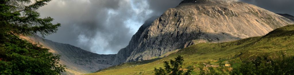
Including Ben Nevis, Glen Coe and the rest of Lochaber, Argyll including the Isles, Loch Lomond, Trossachs and Arran
For snow and avalanche hazard forecasts please visit Scottish Avalanche Information Service